As part of a wider study on changing patterns of malaria in Africa with the University of Oxford's Malaria Atlas Project, the UCSF Global Health Group have been using satellite imagery and geospatial modeling to better understand how Africa has developed over the past 15 years. This story of development has been explored using 4 separate, but related, proxies for development.
Night time lights

Night time light imagery is available globally, going back to the early 1990’s. However, the satellites are not calibrated, making it difficult to compare year on year changes. Using Google Earth Engine, we have created annual intercalibrated images of night time lights across Africa at 1km resolution. The figure below shows a zoom in on Lagos, Nigeria.
Land use
Land use

Using satellite imagery from 2000-2015, we have produced maps of land use/land class for continental Africa. These maps show some dramatic changes over these years. Particularly noticeable is the decline in dense vegetation.
Access to electricity
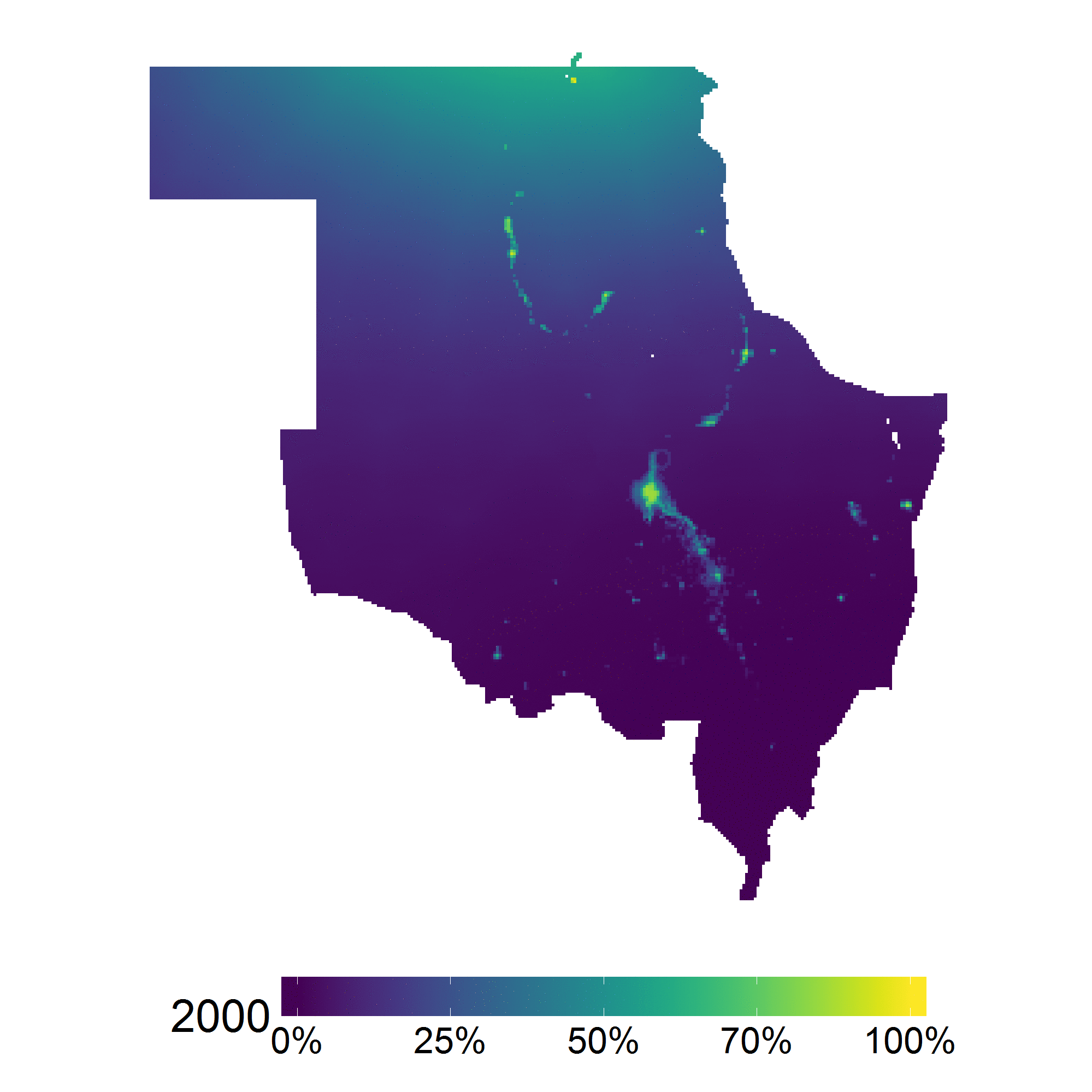
By including data from Demographic and Health Surveys (DHS) in geospatial models, we have produced estimates of the probability of having access to electricity for Africa annually for the period 2000-2014. The figure on the right shows change in this metric in Northern Sudan, along the nile delta.
Development in Africa
As well as looking at changes across these different land use classifications, we have focused in on changes in man-made impervious surfaces, such as asphalt and buildings. This figure shows the probability of an area being man-made impervious surface in and around Addis Ababa, Ethiopia.

Man-made surfaces